The following copyrighted
material is intended for individual use of the researcher, and may not be
copied or distributed without written permission from the
copyright holder. You may use it for non-profit scholarly
purposes. The reference: Rivas, J. A., Rodriguez, J. V., and C. G. Mittermeier
2002. The llanos. pp: 265-273. In Mittermeier, R.A. (ed.) Wildernesses.
CEMEX,
THE LLANOS
The Llanos is an extensive system of grasslands, seasonally-flooded plains, and
forests shared by  (NT0201; 68,544 km2) ecoregions (Olson et al.
2001). Of this, about 61% (275,115 km2) lies within
Located on a large downward flexure of the Earth’s crust, the Llanos lies
at the intersection of the Andes ridge and the Caribbean ridge in the northern
part of
There are several distinct topographic areas in the Llanos, but the general
profile is flat (with a 0.02% slope to the east), with poor acidic soils, and
mostly covered by grasses of low nutritional value. However, some areas with
deeper and richer soils have relatively large patches of dry forest. Fires in
the Llanos are natural, as evidenced by the many species of plants that have
adaptations to 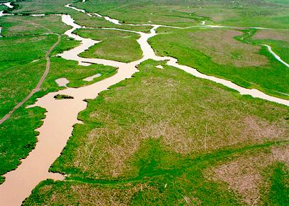 resist or even depend on fire for their life cycle.
However, human-induced fires are far more frequent. Several grasses from the
genera Trachypogon, Andropogon, and Axonopus can
regenerate very quickly after fire and constitute an important source of food
for herbivores. Cattle ranchers often burn the savanna to induce regrowth of
these grasses to feed their cattle. Indigenous people also burn the savannas
regularly to facilitate hunting.
The Llanos can be divided into four principal subregions: the Alluvial
Overflow Plains, the Aeollian Plains, the HighPlains,
and the Piedmont region adjacent to the Andes (Sarmiento 1983). The
Alluvial Overflow Plains are a hyperseasonal wetland situated in a central
tectonic depression in the middle of the Llanos which, due to its dramatic
flooding regime, is particularly unsuited for human 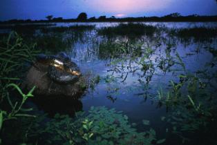 activities. It is very flat, with the highest
elevations being less than 80 m above sea level. The dominant vegetation
associated with this region is a hyperseasonal savanna with few trees or palms.
Gallery (riparian) forest bordering the rivers and patches of dry forest
adjacent to them interrupt the otherwise continuous plain. The entire region is
subjected to two strong and contrasting seasons, a wet
season with torrential rains that often cause rivers to overflow and flood
most of the savanna, and a dry season with prolonged
drought that causes intense fires (Berroterán 1985).
There are three distinct physiographic formations in the overflow plains: bancos,
bajíos, and esteros.
These differ in relative elevation, soil drainage, and vegetation. Bancos,
which account for one third of the region, are found along riverbanks and are
the most elevated areas in the riparian zone. They are 1 to 2 m higher than the
surrounding areas, consist of sandy loams, are poor in organic 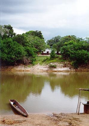 matter, acidic, and have moderate to good drainage
(López Hernández 1995). The dominant vegetation is a gallery forest with
several dominant tree species like palms (Copernicia tectorum), saman
(Pithecellobium saman), masaguaros (P. guachapele),
figs (Ficus spp.), caruta (Genipa americana), palo de
agua (Cordia collococa), and camoruco (Sterculia
apetala) (Ramia 1967;Troth 1979). Occasionally, there may also be larger
trees such as Terminalia amazonica and Ceiba pentandra that can
reach over 50 m. (Hernández et al. 1994), and even the mighty caoba or
mahogany (Swietenia macrophylla) is sometimes present (César
Barbosa, pers. comm.,2002).
The next formation is the bajíos, which are lower regions found further away from the rivers and where sedimentation of finer particles takes place. They cover almost half of the total surface of the overflow plains. They have poorer drainage, their acidic soils contain a high proportion of expandable clay, and they are richer in organic matter than the bancos (López Hernández 1995). During the rainy season, the bajío is partially covered by water, but it dries out completely in November or December. Very few trees can grow under these conditions, among them the palm Copernicia tectorum and the caujaro (Cordia sp.). Palm forests of Mauritia flexuosa, locally known as morichales, are also characteristic of the bajíos, and reach over 18 m in height along waterways, in the most flood-susceptible areas. This is a highly-productive association that provides food for humans and wildlife, as well as thatching material and fiber for knitting hammocks and making cloth. Scattered throughout this formation is an interesting landscape feature locally known assurales or topiales, consisting of thousands of low mounds of dirt covered with grass (predominantly Trachypogon spp.). In the rest of the area, it is common to find spiny shrubs, including barinas (Cassia aculeata), guaica (Randia armatta), Mimosa pigra, M. dormiens, and Hydrolea spinosa, and grasses such as Paspalum spp., Paratheria prostata, Eleocharis spp., Leersia hexandra, and Hymenachne amplexicaulis (Ramia 1967; Troth 1979).
Esteros are the third and lowest region of the overflow plains. They are
characterized by poorly-drained soils with very fine texture in which the
main route of water loss is evaporation. As the dry season progresses, esteros
hold water longer than any other areas, and 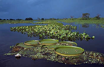 dry up only at the end of the dry season (March or
April). Continued flooding throughout most of the year and clay-heavy soil
inhibit most tree growth, with the exception of occasional palms.
Instead, the esteros are dominated by floating vegetation of which Eichhornia
crassipes and E.azurea are particularly prominent. Other common
floating elements are Salvinia spp., Pistia stratiotes, and Ludwigia
spp., while the rooted vegetation is composed by Thalia geniculata, Ipomoea
crassicaulis, Ipomoea fistulosa, Eleocharis spp. and Cyperus
spp. (Ramia 1967; Troth 1979).
Aeollian Plains are located to the south of the overflow plains and are large extensions
of dunes indicative of arid conditions during glacial periods. This subregion
is covered mostly by low-productivity grasses (e.g. Paspalum,
Trachypogon) (Sarmiento 1983). The gallery forests along small streams have
the only trees in the area, with floristic composition being similar to that in
the overflow plains. Morichales also occur along rivers, streams or pools,
providing water and food for many animals, and often have the highest 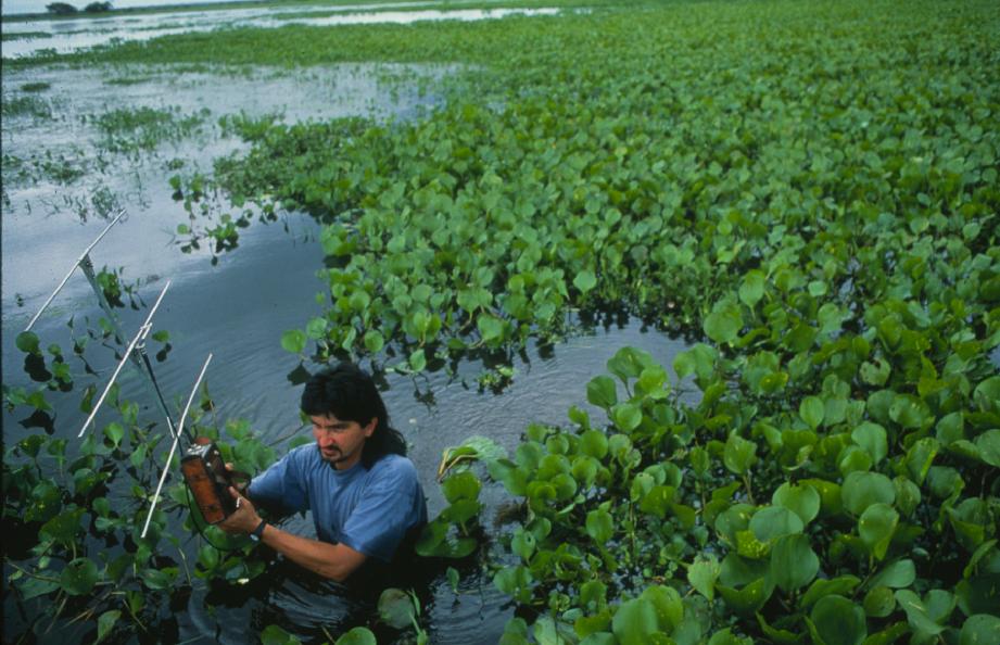 concentrations of species in this subregion.
The High Plains are found in two distinct areas, one in the extreme south of
the Llanos and the other to the east of the overflow plains. The relief is
slightly more hilly and it is possible to find eroded mesas composed of
lateritic crusts that prevent root penetration and constrain tree growth. Soils
are light and even coarse, acidic and rich in iron and aluminum, with the
predominant vegetation cover being grasses of low nutritional value (e.g., Trachypogon
spp.) (Sarmientos 1983). As the great grasslands of the open savanna come
closer to the waterways, woodland savannas of saladillo
(Caraipa llanorum) start to appear. These moderately high,
regionally endemic woodlands become seasonally flooded and their most prominent
characteristic is their ability to inhibit the development of a shrubby
understorey, allowing a herbaceous one instead. There are other interesting
plant associations here, such as those formed by chaparro manteco(Byrsonima
crassifolia), a thick bark tree from which tannins are obtained for the
leather industry. Its fruit is also interesting, 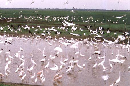 as it is highly fatty, hence the name manteco
("lard"), an irresistible treat for many animals, particularly the
white-tailed deer (Odocoileus virginianus). Other forest associations
include chaparro forest dominated by Curatella americana, a
species highly resistant to fire with large coarse leaves that are used as
sandpaper by local woodworkers. Surales or topiales may also be found scattered
throughout this formation, especially in areas susceptible to flooding between
riparian and chaparro forests.
Piedmont savannas are the highest part of the Llanos and are located near the Andes. Soils are deeper and richer due to alluvial deposition from the Andes, and these are the most forested areas in the Llanos. Dry tropical forest is common here and has a similar floristic composition to that of the bancos. Due to higher fertility and the larger areas of forest, agriculture and logging have taken a stronger toll on this subregion, and cattle ranching is slightly more intensive than elsewhere.
The average temperature in the lower Llanos is 26.6C° , the mean diurnal fluctuation is 9.5C° , and the mean seasonal fluctuation is 3.0C° . Precipitation varies from 1,000 mm on the eastern side to as much as 2,000 mm in the Guaviare River, with over 90% of the rain falling between April and November. The period between January and April is the dry season when all the water bodies shrink or disappear entirely, with the only permanent water being in the esteros and lagoons. The smaller rivers eventually stop flowing, making it necessary for aquatic wildlife to rely on the deeper portions of these waterways to survive. From July to October, there is a distinct wet season when the savanna floods and there is abundant standing water due to rainfall and overflowing of the rivers. The two months between each season are considered transitional. This extreme seasonality is less marked towards the south of the Colombian Llanos, where the dry season may be as short as two months.
Biodiversity
Plant diversity is fairly high, with 3,424 species of vascular plants recorded, while endemism, at 40 species, is low (G. Aymard and R. Duno, in litt., 2002). Among the endemics are species like Vernonia aristeguietae, Bourreria aristeguietana, Stilpnopappus pittieri, S. apurensis, Hymenocallis venezuelensis, Eriocaulon rubescens, Limnosipanea ternifolia,and Gustavia acuta (Huber and Alarcón 1988). It is important to highlight the unique plant communities that grow on the many rocky outcrops found throughout the high plains. These have a highly distinctive floristic composition which includes Vellozia lithophila, Navia spp. -- a small bromeliad with sharp, spiny rosettes on the tips - and a small palm of the genus Syagrus that is highly resistant to fire and which sheds its leaves as a survival strategy during prolonged droughts.
Many Llanos plants have special adaptations to fire, among them Curatella americana, Byrsonima crassifolia, and Bowdichia virgiloides, which have very thick bark insulating the tree. This feature reaches its extreme in the chaparote (Palicourea rigidifolia), which has a woody stem almost 2 cm thick, surrounded by another 2 cm of protective bark.
The fauna in the Llanos is both abundant and diverse. Birds are represented by
approximately 475 species, including both residents and migrants
that gather in large numbers during the dry season to feed in the drying
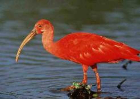
wetlands. 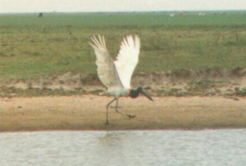 Important groups include herons and egrets, ibises,
storks, ducks, shorebirds, and many birds of prey (Phelps and De Schauensee
1978; WWF, in prep.). Endemism, however is low, with only the Orinoco softtail
(Thripophaga cherriei) considered endemic, although the Orinoco piculet
(Picumnuspumilus)can be considered a near endemic.
Mammals
are represented by 198 species, including 59 species of bats (Ojasti and Boher
1986 cited in Ojasti 1990, CI unpublished data), but only three of these are
endemic. Among nonvolant mammals, the most abundant is the capybara (Hydrochaeris
hydrochaeris), a rodent adapted to a semiaquatic lifestyle. Following in
abundance are white-tailed deer, which are commonly seen 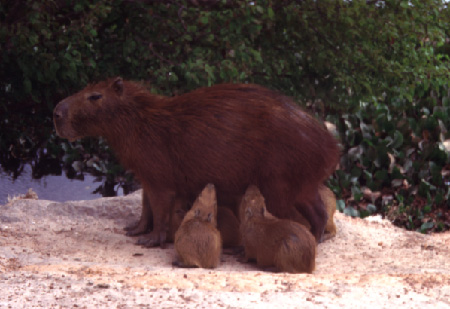 mingling with cattle, and this is one of the main
causes of high mortality due to hoof-and-mouth disease (Eisenberg and Polisar
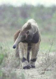
1999). Other mammals found in the savanna include edentates like the giant
anteater (Myrmecophaga tridactyla), the southern tamandua (Tamandua
tetradactyla), and the Llanos long-nosed armadillo (Dasypus sabanicola);
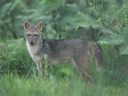
and several carnivores such as the crab eating fox (Cerdocyon thous),
ocelot (Leopardus pardalis), puma (Puma concolor), jaguar (Panthera
onca), and giant otter (Pteronura brasiliensis). Only two species of
monkeys, the red howler (Alouatta seniculus) and the weeper capuchin (Cebus
  olivaceus),
occur in the Venezuelan Llanos, whereas as many as six occur in the Colombian
portion of this region. The Colombian species include again the red howler, the
white-fronted capuchin (Cebus albifrons) replacing the weeper capuchin,
the widow monkey (Callicebus torquatus), the squirrel monkey (Saimiri
sciureus) and two species of night monkey (Aotus
  brumbacki, A. trivirgatus)
usually found in gallery forests. The only endemics are the Llanos long-nosed
armadillo, Orinoco sword-nosed bat (Lonchorhina orinocensis) and
O'Connell's spiny rat (Proechimys oconnelli) (WWF, in prep.).
Reptiles are very abundant in the Llanos, with a total of around 107 species
(WWF, in prep.). Several of these are present in large numbers, including the
giant green anaconda (Eunectes murinus), the spectacled caiman (Caiman
crocodilus), the savanna side-necked turtle (Podocnemis vogli), the
green iguana (Iguana iguana), and the tegu lizard (Tupinambis  teguixin),
and reptile biomass is quite high. Other reptiles found in lower numbers
include the mata-mata turtle (Chelus fimbriatus), the scorpion mud
turtle (Kinosternon scorpioides), the yellow-spotted Amazon river turtle
(Podocnemis unifilis), the giant Amazon river turtle or arrau
(P. expansa), and the dwarf caiman (Paleosuchus palpebrosus).
Endemism is also low among reptiles with one endemic species, a
 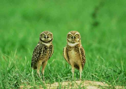 dwarf species of rattlesnake, Crotalus pifanorum, and
two near endemic species, savanna side-neck turtle and the Orinoco crocodile (Crocodylus
intermedius).
Amphibians are very abundant, and especially ubiquitous in the wet season, and
are represented by around 48 species with six endemics: Kennedy's snouted
treefrog (Scinax kennedyi), Blair’s snouted treefrog (S. blairi),
Villavicencio snouted treefrog (S. wandae), 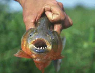 Mathiasson's treefrog (Hyla mathiassoni), Eleutherodactylus
medemi, and Colostethus juanii (WWF, in prep.). The most common
species include the cane toad (Bufo marinus), the emerald-eyed treefrog
(Hyla crepitans), the yellow treefrog (H. microcephala), Rivero’s
tiny treefrog (H. minuscula), the Caracas snouted treefrog (Scinax
rostrata), the Colombia four-eyed frog (Pleurodema brachyops) and
the swimming frog (Pseudis paradoxa).
Fish diversity is also high, with 300 species of fishes in the Llanos. The level of endemism in the Llanos is not well known, but it is estimated that there are between 30 and 40 endemic species -- although some of these might occasionally be found to the south of the Orinoco (C. Lasso, pers. comm., 2002). Noteworthy fish include several species of catfish (Brachyplatystoma filamentosum, Pseudopimelodus apurensi, Phractocephalus hemiliopterus),electric eel (Electrophorus electricus),fresh water rays (Paratrygon aireba, Potamotrygon orbignyi), and piranha (Serrasalmus altuvei, S. elongatus, Pygocentrus notatus). When the rivers flood the savanna, the fish invade the newly-inundated areas to forage and breed, and then return to the rivers in the dry season. However, large numbers often fail to find their way back, becoming isolated in temporary ponds where their density increases as the dry season progresses (Machado-Allison 1993).
Flagship Species
The Llanos is noteworthy for having several flagship species that are among the largest in their taxonomic groups. Reaching between 5 and 6 m in length and with unconfirmed sightings of animals measuring 7 m, the Critically Endangered Orinoco crocodile is one of the larger crocodile species. It is also one of the most threatened species of crocodiles in the world, mainly due to its limited distribution (Thorbjarnarson 1992).
The green anaconda, the largest snake in the world, is commonly found during the dry season in the hyperseasonal savanna of the overflow plains. The arrau or giant Amazonian side-necked turtle is another giant in its group, with a carapace length that can exceed 80 cm making it one of the largest freshwater turtles in the world. The giant otter is the longest otter in the world, and similar in weight to the North American sea otter (Enhydra lutris).
Finally, the capybara is one of the most conspicuous flagships of the Llanos, and the largest rodent in the world. The Llanos subspecies (Hydrochaeris hydrochaeris hydrochaeris) is the largest of all, reaching at least 79 kg and possibly as much as 90 kg. These abundant semiaquatic rodents are commonly found along the many natural channels locally known as caños chigüireros, and spend most of their time in the mud as a way to control their body temperature.
Human Cultures
The 2000 census showed a total of 15,719 indigenous people, belonging to several ethnic groups, living in rural communities within the Venezuelan Llanos. The largest group is the Kariña, with an estimated population of 7,253, followed by the Pumé (or Yaruro) with 5,321, the Warao with 2,485, the Guahibo with 333, the Kuiva (or Cuiba) with 325 and the Wayuu with only two individuals left. The Pumé, Guahibo, and Kuiva occupy the southwestern areas around the Capanaparo and Cinaruco Rivers, and support themselves mostly by fishing, hunting, and traditional agriculture, with yucca and produce being the principal crops. Some of the younger Pumés speak Spanish and occasionally travel to populated areas to work as crop hands or other seasonal jobs, but mostly these groups still live a traditional subsistence life-style. The Kariña and Warao occupy the Eastern high plains, the latter being the predominant ethnic group of the Orinoco Delta, and show varying degrees of acculturation.
In Colombia, there are 11 indigenous groups in the Llanos, the vast majority of which are Sikuani. Others include the Cuia, Saliba, Tenubo, Macaguane, Guahibo, Piapoco, Guayabero, Curripaco, Betoye, and Piaroa. The total population is 23,556 and they inhabit a series of Indigenous Reserves (Resguardos Indígenas) covering 2,818,182 ha (Romero et al., 1993).
Based on projections from the OCEI (2000), the estimated rural population of the Llanos in Venezuela is 714,691, yielding a human density of 2.6 people/km2. In Colombia, the rural population is 351,265, for a population density of 2.0 people/km2. Combining these figures, the total population for the Llanos comes to 1,065,956, or 2.4 people/km2.
Threats
One of the greatest threats to the Llanos is that posed by human-induced fires. Although many plants have adaptations to fire, human use of fire is sometimes extreme. Fire is used mainly in two ways. One is as an aid in hunting, to flush animals or to utilize those killed by fire (especially by nomadic indigenous people). The other use is by ranchers, to get a "green bite" for their cattle by burning large areas at a much higher frequency than would occur naturally. This increased frequency of fires alters floristic composition and favors plants that are particularly fire-resistant.
By
far the most common economic activity in the Llanos is cattle ranching. Most of
the region is in the hands of a few cattle ranchers who own huge properties
ranging from 10,000 to more than 100,000 ha. However, cattle exist at very low
density, usually 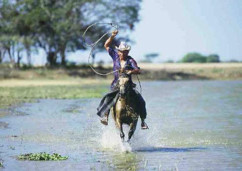 0.2-1 per hectare, and animals range freely, feeding
on natural pasture in otherwise pristine landscapes, moving from banco to bajío
to estero as the dry season progresses, and back as the savannas flood again.
As a result, it appears that the impact of cattle-ranching on wildlife is
fairly low -- a situation similar to areas of traditional, extensive
cattle-ranching in the Pantanal.
Some ranches have engaged in water management, building dikes to manipulate the
water flow in the savanna and minimize the impact of the dry season, thus
increasing the area of estero that retains water for longer periods over
the year at the expense of the bajío, and altering the natural processes of
both ecoystems. Since the Llanos tilt to the East, pretty much every road that
runs north to south has the potential to act as a dike. As a result, the
lower-lying lands suffer premature drought due to the water sequestered in the
upper part of the water-management areas or módulos. During the middle
of the dry season, the gates are opened for a short period of time 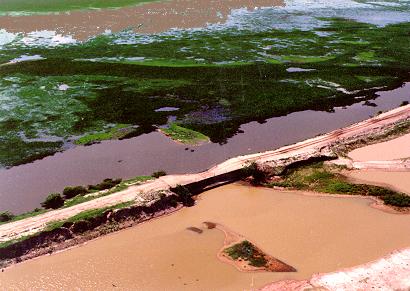 (one or two days) and the lower módulos flood again,
stimulating the growth of the plants there. This draining of the upper módulo
allows a large area to become somewhat dry, permitting grass growth to begin.
This management continues throughout the dry season to provide green pasture
for cattle, despite the lack of rain. When the wet season begins, the gates are
opened again and the water is let out to prevent overflowing and breaking of
the dikes. Such habitat manipulation can greatly increase the production of
cattle in the savanna. However, it is very expensive, and fortunately only very
few ranches can afford it. Most cattle operations are quite simple and not very
different from 400 years ago, with minimal impact on the ecosystem.
Fishing in the rivers has been intense near the populated areas, and the species and size- class composition of the different commercial species have changed over the last 15 years. However, this trend is less important in more remote areas.
Agriculture is even less of a threat. Soils in the Llanos are heavy in texture, acidic, and with low capacity for cationic exchange. This translates into very poor soils with practically no potential for agriculture. The only places where large-scale commercial agriculture is possible are next to dams, where water supply is reliable. Even in such cases, it always requires large amounts of pesticides and fertilizers, making it less profitable and more polluting. On the riverbanks, conditions are different due to regular flooding, which allows soils to be lighter and river sediments to enhance fertility. Some agriculture is possible in these areas, including cotton, corn, and other produce. However, this kind of agriculture can have a damaging impact on wildlife through fragmentation, since these riverbanks act as natural corridors for all forest-dwelling wildlife. Fortunately, such agriculture is not yet carried out on a large scale, being mostly a small-scale family activity. Lack of roads in most of the Llanos also makes all agricultural activities less profitable.
Commercial logging in forested areas is a largely uncontrolled and growing threat. It takes place mainly near the Andes, where most of the forests are located. After logging, areas tend to be replaced by pasture, and there are large areas where dry forest once existed that have now been replaced by cattle ranches.
Exotic species are also a problem. Feral domestic animals such as pigs, cats, and dogs can transmit diseases to the native wildlife, prey on smaller animals, or compete for habitat. House mice (Mus musculus) and rats (Rattus rattus) occur, and even cattle and horses sometimes go feral and live in the wild in vast areas called cimarroneras. The most significant impact for native ungulate species is the incidence of hoof-and-mouth disease, which has contributed to the extirpation of entire populations of white-tailed deer and peccary. Some African grasses such as Cynodon dactylon, Digitaria decumbens, Hyparrhenia rufa, and Urochloa mutica with higher nutritional value than the local species, have also been introduced for cattle. Fortunately, however, there are no reported cases of exotic species replacing native ones, and exotics are still considered a minor problem compared to many other parts of the world. Finally, as in the Pantanal, there has been -- for more than a decade -- a plan for a major hydrological project that would make the Apure River fit for navigation by large vessels for a longer period of the year. This would involve building dikes and damming the river, allegedly decreasing the cost for transporting produce from the Andes to the rest of Venezuela. However, as with the Hydrovia Project in Brazil, such an undertaking would dramatically alter the water regime and ecology of the western part of the Venezuelan Llanos. All species would be affected, especially those under threat such as the Orinoco crocodile and the giant Amazon river turtle, which rely on the seasonal draining of the watershed and consequent exposure of nesting beaches for reproduction. The social impact of the project would also be dramatic, since many populated areas would flood. Local conservation groups have opposed this project and hopefully will continue to be successful; nonetheless, as with the Brazilian Hydrovia, it probably will rear its ugly head from time to time in the future -making it necessary for conservationists to remain ever vigilant.
On the Colombian side, extensive oil development in the Llanos is a fairly recent threat that has brought with it construction of access roads and increased pressure on the natural resources of the area. The threat of an oil spill into a major waterway is also ever-present, exacerbated by the violent activism of radical political groups; indeed, in 2000 over 120 pipelines were bombed in different parts of Colombia. On top of this, efforts to control guerrilla groups by both government military forces and paramilitary groups sometimes involve powerful chemicals, such as defoliants, that can have disastrous impacts on the environment. Since all Llanos watersheds drain to the east, oil spills and other sources of pollution in the Colombian Llanos have the potential to affect a large area extending to the easternmost reaches of the Llanos and other biomes as well.
Conservation
There are five national parks in the Venezuelan Llanos covering a total area of 1,257,618 ha. In addition to these, there are a number of other protected areas, including forest reserves, forested areas, wildlife refuges, and protected zones, and areas of integrated development, which together add up to 6,099,274 ha (Castillo and García 2000). On the Colombian side, there is only one national park, Parque Nacional Tuparro, covering an area of 548,000 ha. Together, the protected areas in the two countries total 6,647,274 ha, representing 14.7% of the region as defined.
However, it is important to note that most of the government protected areas have little if any management. The main reason for the largely pristine condition of the Llanos is the low human population density, combined with the land tenure system in which a few people own very large areas where low impact, low density cattle-ranching is the principal land-use activity. This is quite similar to the situation in the Pantanal region of Brazil, Bolivia, and Paraguay. These landowners enforce strict no-trespassing rules aimed to protect their cattle, but wildlife also benefits.
There are two kinds of commercial wildlife management in the Venezuelan and Colombian Llanos. The first is a traditional harvest of capybaras during Lent, following a Papal Edict permitting use of such meat in place of fish. For over 40 years, the Venezuelan government and more recently the Colombian as well, have authorized cattle ranchers to commercially exploit their capybara populations at this time of year (Ojasti 1991). This practice was considered a sustainable use of the resource and many ranches, such as Hato El Frío, practiced it on a regular basis. – However, things have taken a turn for the worse in recent years, and drastic declines have resulted. In Hato El Frío, for example, a population that had once numbered between 30,000 to 45,000 had dropped to barely 4,000 individuals by 1986 (Ojasti 1978; J. Rivas, unpublished data). This dramatic crash is thought to be the result of increased poaching driven by a declining economy following the drop in oil prices in 1982. Nowadays, capybaras can still be found just about anywhere in the less-populated areas, but very few ranches have harvestable populations.
The other commercial harvest of wildlife in the Llanos involves spectacled caimans (Thorbjarnarson 1991). After the much larger Orinoco crocodile was hunted out in the 1930s and 1940s, and again in the 1970s, the spectacled caiman took over the habitat formerly occupied by the crocodile and its population numbers exploded. The harvest of wild populations for the leather trade proved to be a profitable business, and many ranches started harvesting their caimans. The harvest of over 100,000 animals per year was considered to be sustainable (Thorbjarnarson and Velasco 1999). However, there were many flaws in the implementation of the program, regulations had many loopholes, and the program has shown less than optimum results. Unfortunately, the wildlife protection agency depended on tax revenues from this program, which prevented it from acting rapidly to prevent overexploitation. Skin prices dropped dramatically after 1992 because of increased availability of alligator skins from the U.S., with the result that pressures on Llanos caiman populations declined as well. Since the spectacled caiman is such a resilient species, it is still abundant all over the Llanos. However, as with the capybara, only a few ranches have populations large enough to sustain a commercial harvest.
While caiman leather revenues were booming (1986 to 1992), a large number of ranches built facilities to incubate caiman eggs collected from the wild and kept the animals long enough to grow to a commercially-profitable size (usually one year). Although many of these operations were legitimate, there were also many bogus farms that harvested animals from the wild in an unsustainable manner. The collapse of leather prices drove most of these operations out of business. Today, some of these facilities are being considered for commercial farming of the Orinoco crocodile, the skin of which is far more valuable. However, since this species is on Appendix I of CITES, only second-generation animals born in captivity can be sold, and those supporting exploitation are increasing the pressure to downlist the Orinoco crocodile to Appendix II, so ranching and harvesting can be allowed. Currently, populations of Orinoco crocodiles have experienced only a very modest recovery after much effort and money have been invested in their conservation. Consequently, conservation groups in Venezuela strongly oppose downlisting, fearing that it might follow the slippery slope taken by the caiman ranches -- with disastrous results for a far less abundant and less adaptable species than the caiman.
Overall, most of the Llanos is still in very good condition and we estimate that approximately 80% remains in wilderness state. Although most of it is being or has been used for cattle ranching, the intensity of the operation is such that the impact on the habitat is very mild. In some places where human density is higher, there have been local extinctions, but this trend disappears as one moves away from the cities. Major modifications to the environment, such as dams, dikes and deforestation, have fortunately not yet taken a large toll on these vast plains, and the low human density over most of the area prevents other significant impacts. Overall, there is great hope for this wilderness to remain basically unchanged, at least for the time being.
Literature Cited
BERROTERÁN, J. L. 1985. Geomorfología del
area de Llanos bajos centrales Venezolanos. Sociedad Venezolana de Ciencias
Naturales 143: 31-77.
CASTILLO, A. O. and V. A. GARCÍA. 2000. Áreas bajo regimen de administración especial por figura. Direccion General de Planificación y Ordenación del Ambiente. Direccion de Ordenacion del Territorio, Ministerio del Ambiente y de los Recursos Naturales Renovables. Venezuela
EISENBERG, J. F. and J.R. POLISAR. 1999. The mammals of North-Central Venezuela. Bulletin of the Florida Museum of Natural History 42:115-.160.
HERNÁNDEZ- C.J.I., M.E. ROMERO, H. SÁNCHEZ
& G. SARMIENTO. 1994. Sabanas Naturales de Colombia..Banco de Occidente, Bogotá.
207 pp
HUBER, O.,
and C. ALARCÓN. 1988. Mapa de vegetación de Venezuela. 1:2,000,000.
Ministerio del Ambiente y de los Recursos Naturales Renovables, Caracas,
Venezuela.
THORBJARNARSON, J. (Compiler) H. MESSEL, F.W. KING and J.P. ROSS (Eds.). 1992. Crocodiles: An Action Plan for Their Conservation. IUCN Gland Switzerland
LASSO, C., D. LEW, F. PROVENZANO, O.
LASSO-ALCALÁ, D. TAPHORN, and A. MACHADO-ALLISON. 2002. Biodiversidad
Ictiologica Continental de Venezuela: lista actualizada de especies y
distribucion por cuencas . Memorias de la Fundación La Salle de Ciencias
Naturales (en prensa).
LÓPEZ-HERNÁNDEZ,
D. 1995. Balance de elementos en una savana inundada. Mantecal, Estado Apure,
Venezuela. Acta Biológica Venezuelica 15: 55-88.
MACHADO-ALLISON,
A. 1993. Los peces de los Llanos de Venezuela: un ensayo sobre su historia
natural. UCV, Consejo de Desarrollo Científico y Humanístico, Caracas,
Venezuela.
OFICINA CENTRAL DE ESTADÍSTICA E INFORMÁTICA, Venezuela (OCEI). 2000. Online: http://www.ocei.gov.ve/
OJASTI, J. 1978. The relation between population and production of the capybara. Unpublished Ph.D. dissertation, University of Georgia, Athens.
OJASTI, J. 1990. Las comunidades de mamíferos
en sabanas neotropicales. 3. In: SARMIENTO, G. (Ed.). Las Sabanas
Americanas: aspectos de su biogeografía y utilización. Fondo Editorial Acta
Científica de Venezuela, Caracas. Pp: 259- 29.
OJASTI, J.
1991. Human explotaition of capybaras.
In: ROBINSON, J. G. and K. H. REDFORD (Eds.). Tropical Wildlife Use and
Conservation. University of Chicago Press, Chicago. Pp. 236-252.
OJASTI, J.
and S. BOHER. 1986. Bases para el diseño de medidas de mitigación y control
de las cuencas hidrográficas de los ríos Caris y Pao Edo. Anzoategui V
Fauna. Universidad Central de Venezuela MENEVEN Caracas.67 pp.
OLSON, D. M., E. DINERSTEIN, E. D. WIKRAMANYAKE, N. D. BURGESS, G.V. N. POWELL, E. C. UNDERWOOD, J. A. D'AMICO, I. ITOUA, H. E. STRAND, J. C. MORRISON, C. J. LOUCKS, T. F. ALNUTT, T. H. RICKETTS, Y. KURA, J. F. LAMOREUX, W. W. WETTENGEL, P. HEDAO, and K. KASSEM. 2001. Terrestrial ecoregions of the world: a new map of life on earth. BioScience 51 (11): 933-938.)
PHELPS, Jr. W. H. and M. DE SCHAUENSEE. 1978. A guide to the birds of Venezuela. Princeton University Press, Princeton, New Jersey.
PÉFAUR, J. E. and J. A, RIVERO. 2000.
Distribution, species-richness, endemism, and conservation of Venezuelan
amphibians and reptiles. Amphibian & Reptile Conservation 2:42-70.
RAMIA, M.
1967. Tipos de savana en los Llanos de Venezuela. Boletin de la sociedad
Venezolana de Ciencias Naturales. 28: 264-288.
RAMIA, M,
1972. Cambios en la vegetacion del hato El Frio (Alto Apure) causados por
diques. Boletin de la sociedad Venezolana de Ciencias Naturales 30:
57-90.
ROMERO, M.
E., L. M. CASTRO and A. MURIEL 1993. Geografic Humana de Colombia. Region de la
Orinoquia, Vol. 1. Instituto colombiano de Cultura Hispanica, Bogota.
SARMIENTO, G. 1983 The savannas of tropical America. In: BOURLIERE, F. (Ed.) Ecosystems of the world. Vol 13. Tropical savannas. Elsevier Scientifc Publishing Co., New York. pp. 245-288.
THORBJARNARSON, J. B. 1991. An analysis of the spectacled caiman (Caiman crocodilus) harvest program in Venezuela. In: ROBINSON, J. G. and K. H. REDFORD (Eds.) Tropical Wildlife Use and Conservation. Chicago University Press, Chicago. pp. 217-235.
THORBJARNARSON, J. B. and A. VELASCO. 1999. Economic incentives for management of Venezuelan Caiman. Conservation Biology. 13: 397- 406.
TROTH, R. G. 1979. Vegetational types on a ranch in the central Llanos of Benezuela. In: J. F. EISENBERG (Ed.) Vertebrate ecology in the Northern Neotropics. Smithsonian Institution, Washington D. C. pp: 17-30.
VILA, P. 1960. Geografía de Venezuela. 1. El territorio Nacional y su ambiente físico. Ministerio de Educación. Dirección de cultura y Bellas Artes, Caracas.
WWF (World Wildlife Fund). in prep. WWF Ecoregion - Species Database. Washington, DC. www.worldwildlife.org/science